P. O. Box 88 Kamuli Uganda | Tel: +256 704522550 | Email:[email protected]. District Website Portal: https://www.kamuli.go.ug

Overview
GENERAL INFORMATION
The total population for Kamuli district local government as per the National Housing census 2014 is 486,319, people.Of whic 236,389 are males and 249,930 are females.
The district is comprised of (four) 4 constituencies and these include, Bugabula South, Bugabula North, Buzaaya and Kamuli Municipality.
The population distribution in all the constituencies is as follows; Bugabula South has a population of 156,172, Bugabula North has 113,848 people, Buzaaya has 157,315 people while Kamuli Municipalityis composed of 58,984 people.
The Municipality which was operationalised in 2016, is comprised of 2 divisions, that’s the Northern Division and Southern Division.
At the district level, the district is comprised of 1(one) municipality with two divisions ie Northern Division and Southern Division. and 14 (fourteen) Sub counties and these include; Balawooli, Namasagali, Nabwigulu, Butansi, Bulopa, Kitayunjwa, Namwendwa, Nawanyago, Kisozi, Wankole, Bugulumbya,Mbulamuti, Magogo and Kagumba and all sub counties have access to power.
The approved town council as at 2017/2018 are six and these include; Kisozi Town Council, Kasambira Town Council, Mbulamuti town Council, Namwendwa Town Council, Balawooli Town Council and Nawanyago Town Council.
The district has total number of 81 parishes while the total number of villages are 773 .Of which 693 are for the rural and 80 zones for the urban.
For more details please read the National Population and Housing Census 2014 kamuli Area Specific Profiles
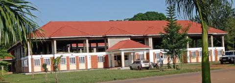
COMPLETED EASTERN WING GROUND FLOOR OF THE NEW ADMINISTARTION BLOCK AT DISTRICT HEADQUARTERS